
-
ÖFFNUNGSZEITEN EINTRITTSPREISE Di. bis So.: 10 bis 16 Uhr Erwachsene 4,00 € Montags geschlossen Ermäßigt 3,00 € Gruppen ab 12 Pers. p.P. 3,00 € Geschlossen an: Kinder | Schüler 1,00 € Neujahr, Faschingsdienstag, Schüler im Klassenverb. 1,00 € Karfreitag, Allerheiligen, Familienkarte 6,00 € Heilig Abend, 1. Weihnachtstag, Kinder unter 6 Jahren frei Silvester Telefonnummer: +49 (0) 9421 944-63 222
Straubing / Sorviodurum – Entwicklung von Fluss-, Agrar- und Stadtlandschaft an der europäischen Lebensader Donau von der keltischen Siedlung bis zur GegenwartStraubing / Sorviodurum – Development of River-, Agricultural-, and City Landscape on the European Lifeline Danube from the Celtic Settlement to the Present DayProf. Dr. Günther Moosbauer, Gäubodenmuseum, Stadt Straubing
Prof. Dr. Gerhard Schellmann, Physische Geographie, Friedrich-Otto-Universität Bamberg (kooptiert)
Prof. Dr. Jörg Völkel, Geomorphologie & Bodenkunde GeoBoku, TU München
Kurzfassung / Summary:
Das Vorhaben erforscht die Paläoumwelt der Stadt Straubing und ihres Umlandes unter besonderer Berücksichtigung natürlicher Flusslaufverlagerungen und wasserbaulicher Veränderungen an der Donau und an ihren Tributären unter Einbezug der Chronik und Schadwirkung von Hochflutereignissen. Erste wasserbauliche Maßnahmen sind für die provinzialrömische Zeit unter anderem in Form von Kaianlagen und Piers belegt und werden für die vorangegangene keltische Siedlungsphase am selben Ort postuliert. Die Rekonstruktion der Flusslandschaft an der Donau um die Zeitenwende ist der erste Schwerpunkt des Vorhabens. Außerhalb der aktiven Flusslandschaft werden als zweiter Schwerpunkt die Bodenlandschaft und die Entwicklung der Agrarlandschaft von Straubing über alle Siedlungsphasen seit Beginn des Ackerbaus vor ca. 7000 Jahren über die Einwanderung der sogenannten Bandkeramiker erforscht. Zusammen mit der Entwicklungsgeschichte der römischen und mittelalterlichen Stadt Straubing liegt ein dritter Schwerpunkt auf der Laufumlenkung des Hauptabflusses der Donau im Zuge der Errichtung der Sossauer Bschlacht im Jahre 1480. Die fluviale Geomorphodynamik und die Paläo-Flusslandschaft vor und nach dieser Maßnahme werden rekonstruiert. Ein vierter Schwerpunkt befasst sich mit den flussbaulichen Maßnahmen im Zuge der Etablierung der Dampfschifffahrt auf der Donau bis hin zum Ausbau zur Bundeswasserstraße im Zuge der Rhein-Main-Donau-Baumaßnahmen (RMD) und Verlagerung des Straubinger Donauhafens.
The project investigates the paleoenvironment of the city of Straubing and its surrounding area with special regard to natural river course shifts and hydraulic engineering changes on the Danube and its tributaries, including the chronicle and damaging effects of flood events. First hydraulic engineering measures are attested for the provincial Roman period, among others in the form of quays and piers, and are postulated for the preceding Celtic settlement phase at the same site. The reconstruction of the river landscape on the Danube around the turn of the Roman period is the first focus of the project. Outside the active river landscape, the soil landscape and the development of the agricultural landscape of Straubing over all settlement phases since the beginning of agriculture about 7000 years ago are investigated as a second focus via the immigration of the so-called Bandkeramiker. Together with the history of the development of the Roman and medieval town of Straubing, a third focus is on the course diversion of the main discharge of the Danube in connection with the construction of the Sossauer Bschlacht in 1480. The fluvial geomorphodynamics and the paleo-river landscape before and after this measure are reconstructed. A fourth focus deals with the river engineering measures in the course of the establishment of steam navigation on the Danube up to the development to a federal waterway in the course of the RMD construction measures and relocation of the Straubing Danube port.
Laufzeit / Runtime:
Das Vorhaben startete unter Einbezug gemeinsamer Vorarbeiten (u.a. DFG-GRK 462) in Form einer Pilotierungsphase im Sommer 2018 / The project started with the inclusion of joint preliminary work (a.o. DFG-GRK 462) in the form of a pilot phase in summer 2018.
Projektfinanzierung / Funding:
Stadt Straubing, TU München
MitarbeiterInnen / Staff:
Ildiko Bösze, M.A.
Sarah Putzhammer, M.Sc.
N.N. (DoktorandIn Geschichtswissenschaften / PhD student Historical Sciences)
N.N. (DoktorandIn Geomorphologie & Bodenkunde / PhD student Geomorphology & Soil Science)
Bachelor- und Masterarbeiten / Bachelor and Master Theses:
Wir vergeben laufend Studienabschlussarbeiten / We are constantly assigning final theses
Kontakt / Contact:
Prof. Dr. Jörg Völkel, TUM
Phone: +49 8161 71 2500
Email: geo@wzw.tum.de
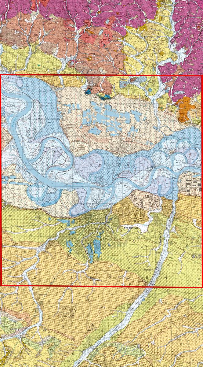 GK 25 7041 Münster und GK 25 7141 Straubing.
© Bayerisches Landesamt für Umwelt, www.lfu.bayern.de
Das Untersuchungsgebiet reicht von den Tributären, die das Kristallin im Norden verlassen bzw. aus den Tertiärbuchten des Vorderen Bayerischen Waldes heraustreten, über die Nieder- und Hochterrassenlandschaften nördlich und südlich der Donau-Auenlandschaft bis an das lößbedeckte Tertiärhügelland im Süden / The study area extends from the tributaries leaving the crystalline in the north or emerging from the Tertiary bays of the Anterior Bavarian Forest, through the low and high terrace landscapes north and south of the Danube floodplain to the Loess covered Tertiary Hill Country in the south.
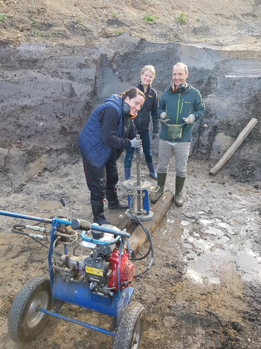 Rammkernsondierungen Straubing Römerhafen Oktober 2019 / Vibra Coring Straubing Roman port October 2019 (© Jörg Völkel, TUM)
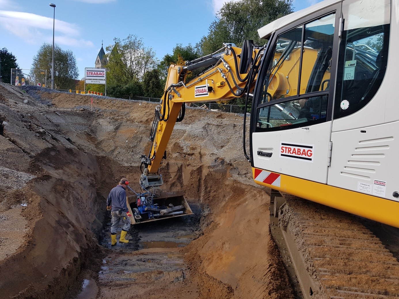 Prospektionsarbeiten Straubing Römerhafen Oktober 2019 / Prospecting work Straubing Roman port October 2019 (© Jörg Völkel, TUM)
 Bohrprospektion Straubing Römerhafen Oktober 2019 / Prospecting work Straubing Roman port October 2019 (© Jörg Völkel, TUM)
ERT-Prospektion im Eglseer Moos / Electrical Resistivity Tomography ERT Eglseer Moos (© Jörg Völkel, TUM)
.jpg) Geophysikalische Prospektion (ERT) im Eglseer Moos, Stadt Straubing / Geophysical Prospection (ERT) Eglseer Moos, City of Straubing (© Sarah Putzhammer, TUM)
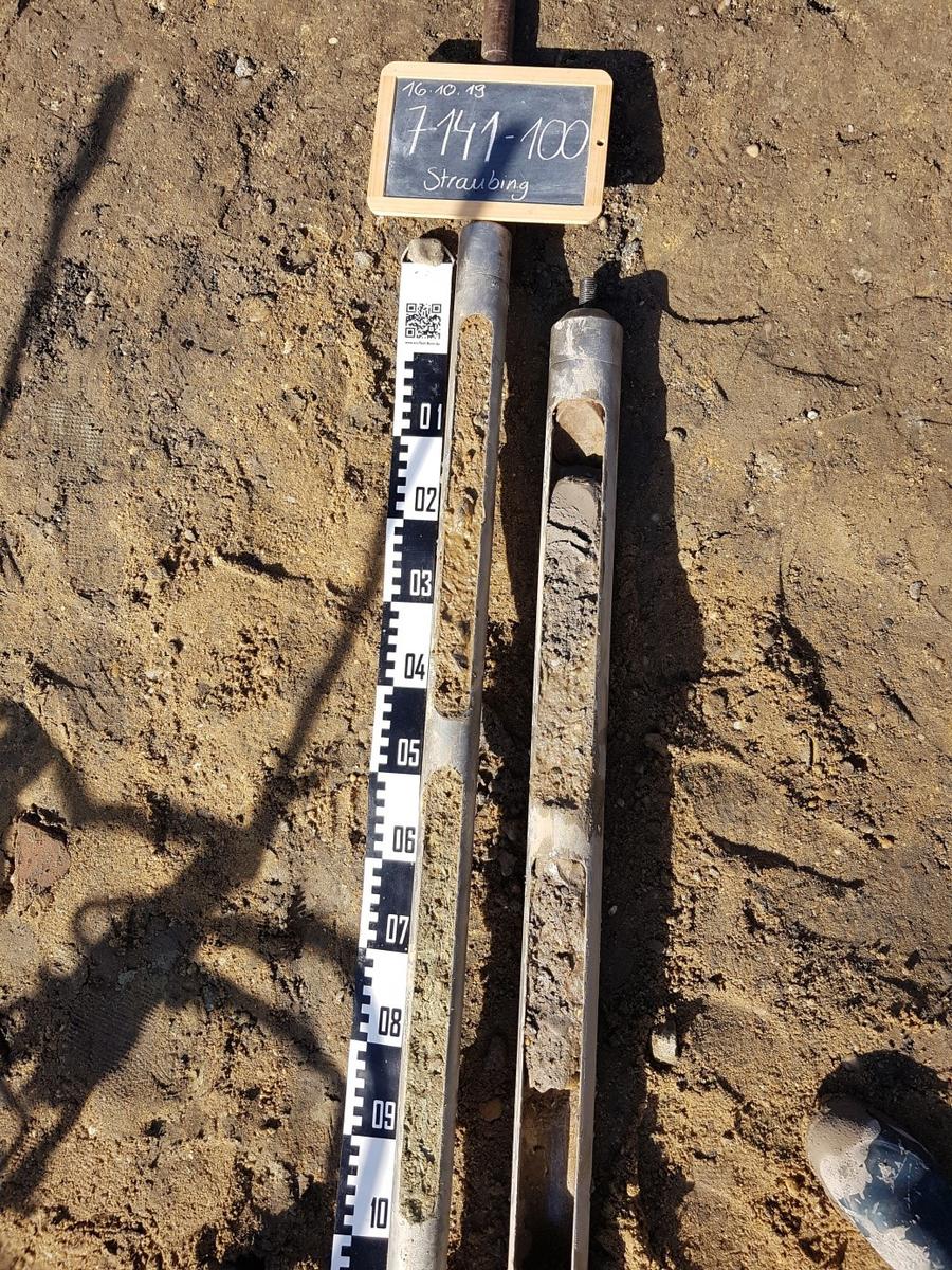
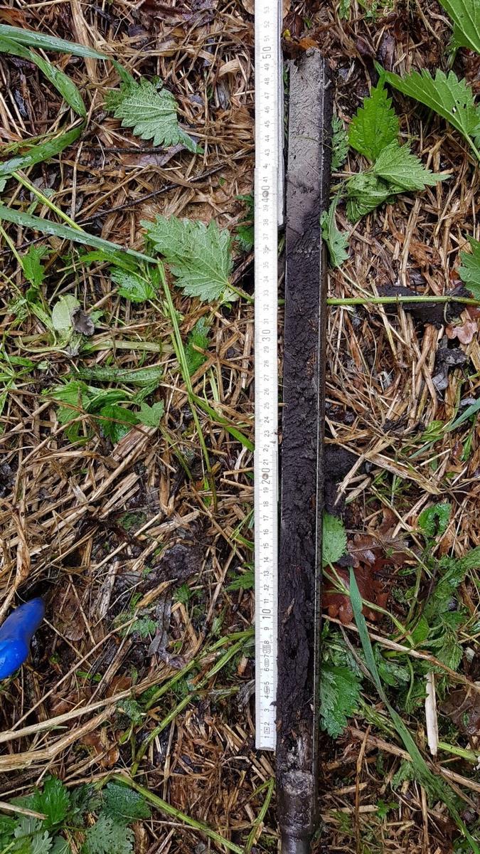 Bohrsondierung Eglseer Moos / Drilling Prospection Eglseer Moos (© Jörg Völkel, TUM, 2021)
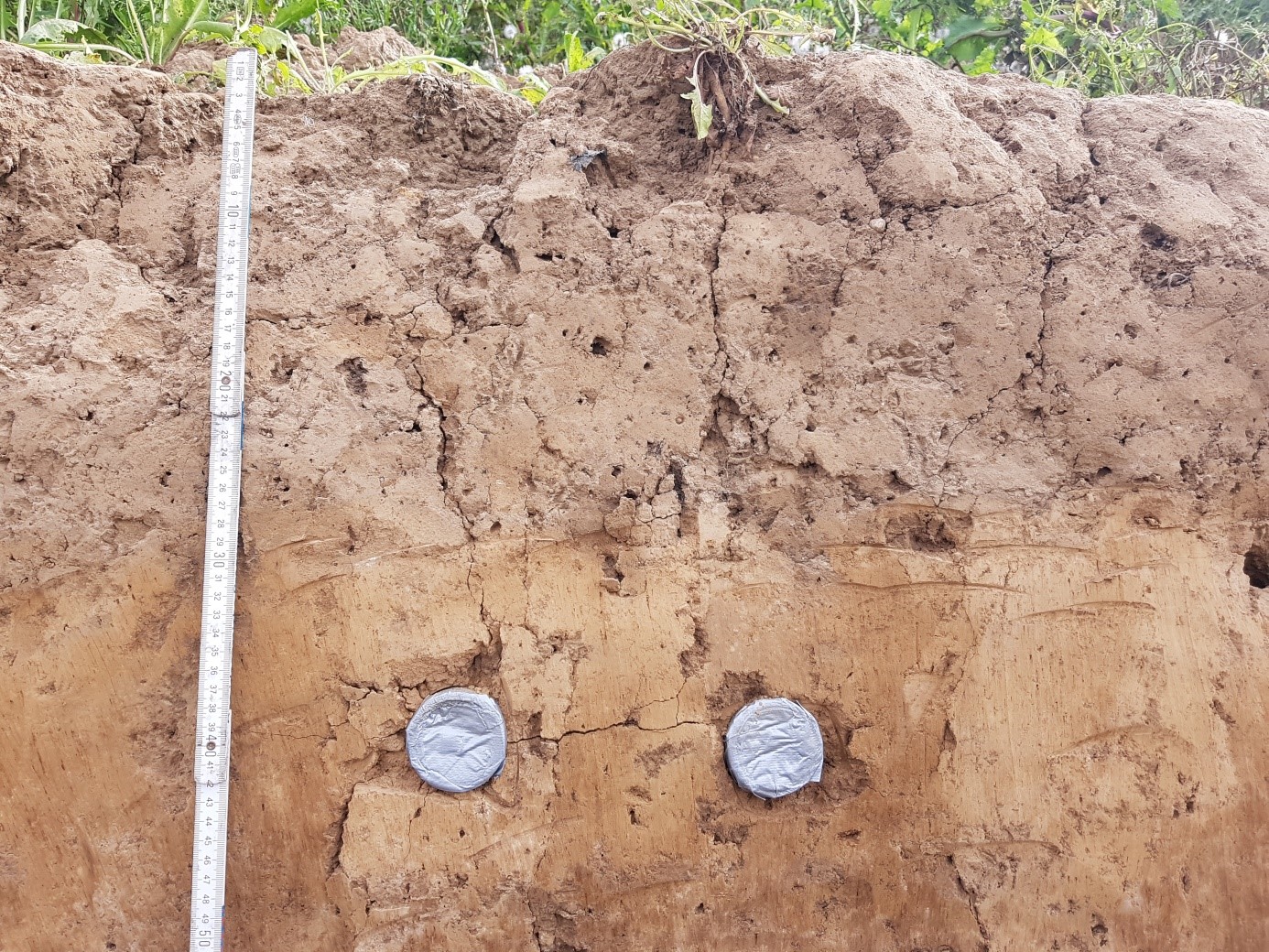
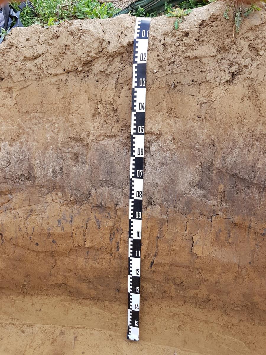 Schwarzerde-Parabraunerde-Sequenz Straubing bedeckt von Kolluvium und Pflughorizont Ap / Black Soil - Luvisol - Sequence covered by colluvial sediments and plough horizon (© Jörg Völkel, TUM, 2021)
|
.jpg)